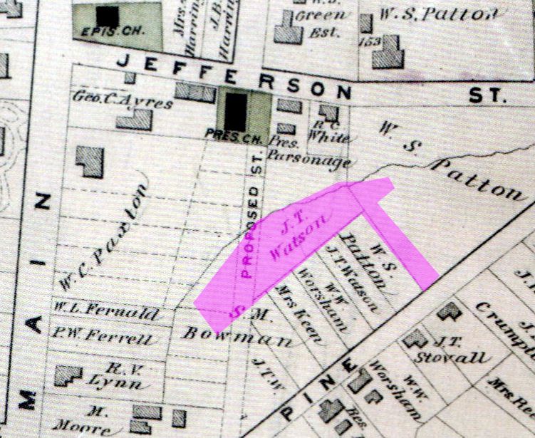
Once called Watson’s Field after its owner in the late 1800s, the proposed location of the Old West End Commons was and still is one of the largest open areas in the heart of the city. It has little street frontage, a spring, a creek, and a steep slope in some areas.
Legend has it that a century ago tobacco farmers used the area in town for the markets to graze their horses and mules.
The working name of “Commons” for this area comes from the country’s oldest urban oasis, the Boston Common, where Bostonians grazed their cows in the 17th through 19th centuries.
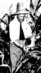 In the 1940s, Dr. James Madison Shelburne (1867-1951), pastor emeritus of First Baptist Church, used the area to grow vegetables, particularly corn and tomatoes, for his Old West End neighbors. In 1947, The Bee ran a story about his hobby and how he provided food for many in the Old West End. In that year he gave at least a thousand ears of corn and the fruit from 115 hills of tomatoes to his neighbors. But his garden wasn’t limited to corn and tomatoes. In the preceding year, his giant pumpkins took first, second, and third prize at the Danville Fair. Read more about Dr. Shelburne here.
Though the identity of later growers is unknown, a 1975 photo in the Danville Register shows the cornfield still in use.
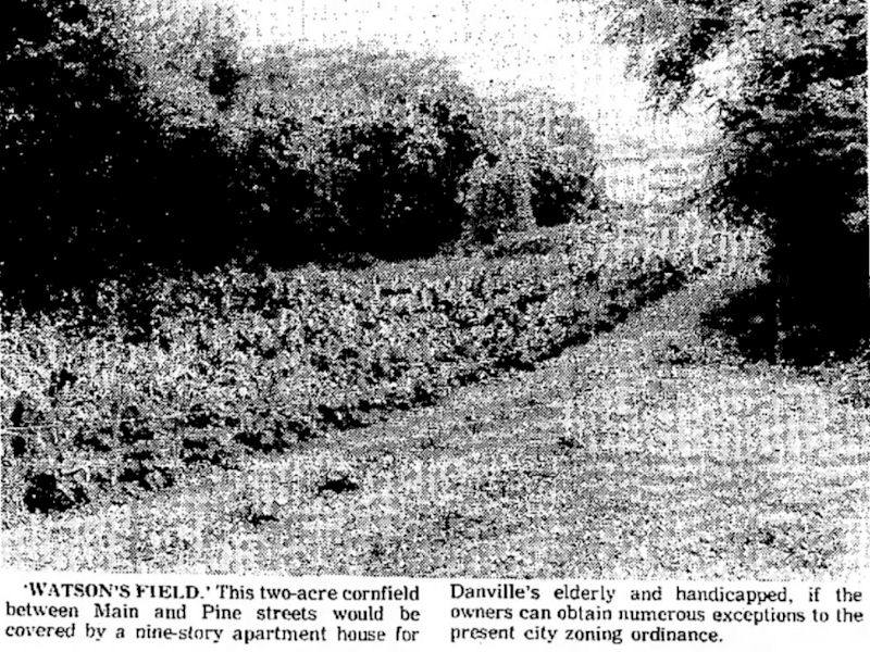
It was at this time that a nine-story mid-rise apartment was proposed for the area. A Reston architectural firm specializing in government-subsidized apartments asked the Danville Planning Commission to consider their preliminary plans. The Planning Commission approved but was overturned by the City Council due to neighborhood opposition.
More recently, in 2014, a city-sponsored study called the Old West End Revitalization Strategy recommended acquisition of Watson’s Field and neighboring properties to create community recreation space and gardens.
This was followed in 2018 with a report completed by a summer intern from the Danville Regional Foundation and Friends of the Old West End called Open Space Design in the Old West End National Historic District.
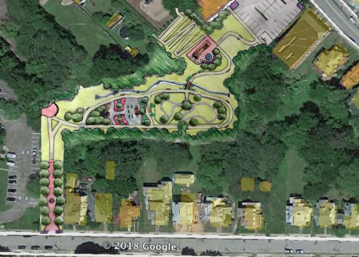
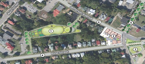
Now, after some changes to the boundaries of the parcel, McGill Associates has been retained by the city to develop a more complete design. Community input is being requested, and a representative from McGill will be on site on Pine Street on Wednesday, May 4, from 9:00 a.m. to 6:00 p.m. Please come out to express your ideas and concerns about this urban oasis.
Hello! One of the images in your post is of the Beers map of Danville. I would like to see that map for my own research. How can I access that map? Thank you. -Dale