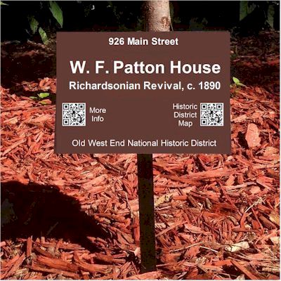
 The City of Danville has been awarded $4,230 by the Virginia Department of Historic Resources for the development of a Story Map and the placement of small yard markers (8 x 10″) on properties in the Old West End National Historic District. Each marker will include the historic name of the property, its architectural style, and approximate build date. The markers will also have two smart-phone-readable QR codes. Scanning one code will provide general information about the Old West End by linking to a story map that can guide exploration of the entire district. The second code will link to more detailed historic information about the property. The project will begin with fifty (50) markers.
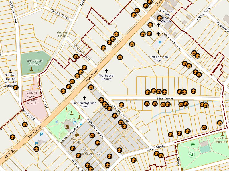
The City’s Geographical Information Team recently released the Old West End Story Map with most of the 50 properties already included. This new addition to the City’s GIS applications showcases some of the beautiful properties and the rich history associated with them. Visitors and residents can enjoy taking a tour of the OWE, street by street, and learn about the history of the homes as well as some of the Danvillians that have lived there. By clicking on each icon, users can view some basic information about each property, and then use the hyperlinks for even more in-depth information. The map tour will be updated regularly as new information becomes available.
Friends of the Old West End has been and is working to provide the detailed information for each of the 50 properties. Much of that detail has already appeared online in the Old West End Blog and has been linked from the Old West End Gazette newsletter. In addition, author Gary Grant has given permission to republish property information included in Victorian Danville.
Friends will soon be contacting the 50 volunteer property owners to confirm their participation and arrange for installation. While the markers are largely funded by the grant, some costs including installation will be the responsibility of the property owners.
